You are using an out of date browser. It may not display this or other websites correctly.
You should upgrade or use an alternative browser.
You should upgrade or use an alternative browser.
Q-Bam Historical Map Thread
- Thread starter The Alternative
- Start date
-
- Tags
- historical maps q-bam
Brasília was not officially founded until 21 April 1960, before that, the federal capital of Brazil was still located in Rio de Janeiro.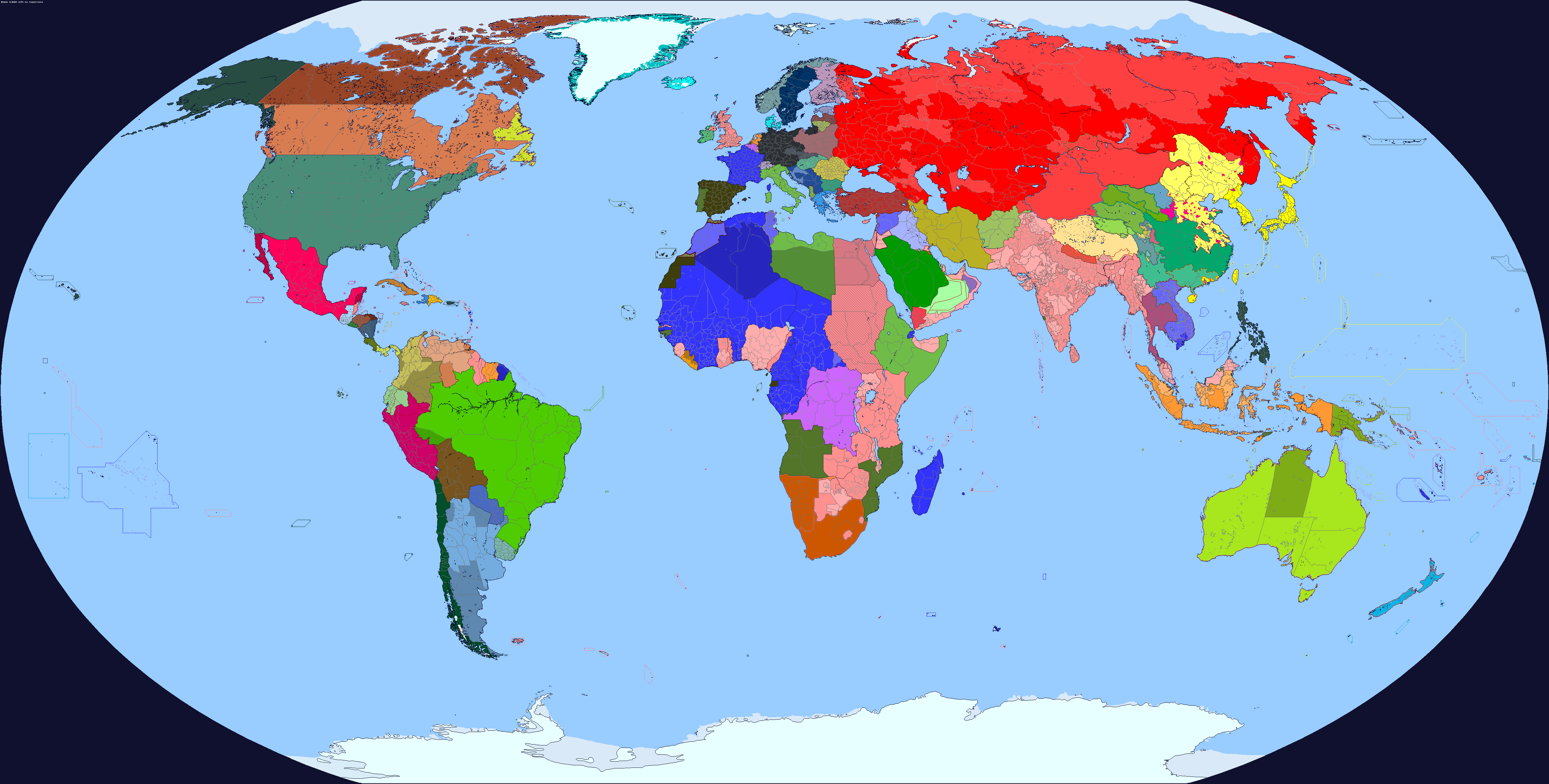
September 1, 1939
Trying out some new border colors, and trying to represent still-official nations like the Dominions of GB and vassal/client/autonomous states that still have political relevance
These are the colors that I personally use, what do people of this thread think of them?honestly, maybe?
personally i use orange for the USSR and i really should've made it clear from the get-go that red isn't bad, but eye-searing colours in general are
View attachment 882907
i suppose i may as well give an example of the kind of red i'd use from a map i'll probably never finish
I like the vibe its murky and malone I love it :3These are the colors that I personally use, what do people of this thread think of them?
View attachment 883176
I know. However, the brazilian govt. set aside territory for the district which was separated from the surrounding region.Brasília was not officially founded until 21 April 1960, before that, the federal capital of Brazil was still located in Rio de Janeiro.
When did this territorial allocation for Brasília begin? asking because I want to put that territory in pre-1960s maps too assuming that it is correct, I heard that proposals to build an in-land capital named Brasília date from as early as like the 1820s or so, shortly after Brazil gained independence.I know. However, the brazilian govt. set aside territory for the district which was separated from the surrounding region.
January 18, 1922, when President Epitácio Pessoa of Brazil issued Decree 4494. This was the first truly official attempt to build the capital thereWhen did this territorial allocation for Brasília begin? asking because I want to put that territory in pre-1960s maps too assuming that it is correct, I heard that proposals to build an in-land capital named Brasília date from as early as like the 1820s or so, shortly after Brazil gained independence.
Lovely, Although a part of me would like to see a light pale blue for the seas.These are the colors that I personally use, what do people of this thread think of them?
View attachment 883176
I like how everything in Asia is freehand except Nepal and the Kumul KhanateView attachment 883091
a discord rp server, the map is from 1740 but that starting map was 1700 and i have that overlayed, spain is grey bc they are in a bourbon union with france and the blue and yellow turned into grey, not the biggest fan of the 1700 map that someone made bc it isnt entirely accurate and no subdivisions but its still good
but its not bad
now those are some good-looking colours, definitely fit the dark water you have going on there. what's the story behind the map, though? is it an IRL one or an AH one?These are the colors that I personally use, what do people of this thread think of them?
View attachment 883176
Cheers! I make most, but not all of these colors myself because the default colors in maps featured in here hurts my eyes, except for the colors of the USSR, I did not make it, nor do I remember who made it, so all credits due, I think that Ulyanovsk made it on the WorldA thread, but I cannot be 100% certain.now those are some good-looking colours, definitely fit the dark water you have going on there.
It is an IRL one, however, I wanted to say that 1. I do not like publicly sharing my maps for the time being, and 2. I no longer use WorldA and Q-BAM, this is an old map, however, you can view a map series with my same WorldA color scheme in here on The Death of Russia Timeline, Sorairo even approved the map I made as an official map of the TL on its threadmarks, which gave me a sense of accomplishment that I will carry for the rest of my life lol.what's the story behind the map, though? is it an IRL one or an AH one?
thank you for the answer, and the examples provided of what colours you used. though i will openly admit to never having read death of russia, but i have heard of it.Cheers! I make most, but not all of these colors myself because the default colors in maps featured in here hurts my eyes, except for the colors of the USSR, I did not make it, nor do I remember who made it, so all credits due, I think that Ulyanovsk made it on the WorldA thread, but I cannot be 100% certain.
It is an IRL one, however, I wanted to say that 1. I do not like publicly sharing my maps for the time being, and 2. I no longer use WorldA and Q-BAM, this is an old map, however, you can view a map series with my same WorldA color scheme in here on The Death of Russia Timeline, Sorairo even approved the map I made as an official map of the TL on its threadmarks, which gave me a sense of accomplishment that I will carry for the rest of my life lol.
View attachment 882138
HRE 1618 and 1648. Some outside areas also included arbitrarily.
I would just add that the Italian lands you've depicted in 1618 were still a part of the HRE in 1648.
I mean, it was only really the Savoyards that actually turned up to the Imperial diets. Imperial control over Italy was highly theoretical at this pointI would just add that the Italian lands you've depicted in 1618 were still a part of the HRE in 1648.
I mean, it was only really the Savoyards that actually turned up to the Imperial diets. Imperial control over Italy was highly theoretical at this point
Savoy didn't actually attend the Diet much at all in the era either to be honest. But that region of Italy (Piedmont, Liguria, Lombardy) is filled with small 'imperial fiefs' which held their lands in fief to the Emperor directly, much like the imperial villages or knights of Germany. Savoy spent decades lobbying the Imperial Court for permission to annex those lands.
The local princes also paid fealty to the Emperor, for instance a significant escalation of the Mantuan Succession War was caused by Charles I Gonzaga assuming the Ducal titles before being invested officially by the Emperor. Mantua itself was later placed under a Ban around the Spanish Succession, which was how the Habsburgs gained its lands.
A further example would be the Oñate Treaty, by which the Emperor granted sovereignty over Finale Ligure and Piombino to Spain.
There's also the office of Commissioner General, who was the deputy of the Emperor within HRE Italy. The office was first created in the early 17th century, and lasted until 1639 when it was replaced by ad hoc commissioners only to be renewed in 1715. The Commissioner generally oversaw things like imperial rights, legal matters relating to Italy, and financial contributions to the Emperor.
I think HRE iinfluence in northern italy at that point can be compared to contemporary european union or european councilSavoy didn't actually attend the Diet much at all in the era either to be honest. But that region of Italy (Piedmont, Liguria, Lombardy) is filled with small 'imperial fiefs' which held their lands in fief to the Emperor directly, much like the imperial villages or knights of Germany. Savoy spent decades lobbying the Imperial Court for permission to annex those lands.
The local princes also paid fealty to the Emperor, for instance a significant escalation of the Mantuan Succession War was caused by Charles I Gonzaga assuming the Ducal titles before being invested officially by the Emperor. Mantua itself was later placed under a Ban around the Spanish Succession, which was how the Habsburgs gained its lands.
A further example would be the Oñate Treaty, by which the Emperor granted sovereignty over Finale Ligure and Piombino to Spain.
There's also the office of Commissioner General, who was the deputy of the Emperor within HRE Italy. The office was first created in the early 17th century, and lasted until 1639 when it was replaced by ad hoc commissioners only to be renewed in 1715. The Commissioner generally oversaw things like imperial rights, legal matters relating to Italy, and financial contributions to the Emperor.
This is great. I love it. That being said, I always assumed that the territory of the Thuringii would be larger. Reality tends to kick you in the teeth. Oh well...
Kaleb's Aksumite Empire was also nice to see.
Last edited:
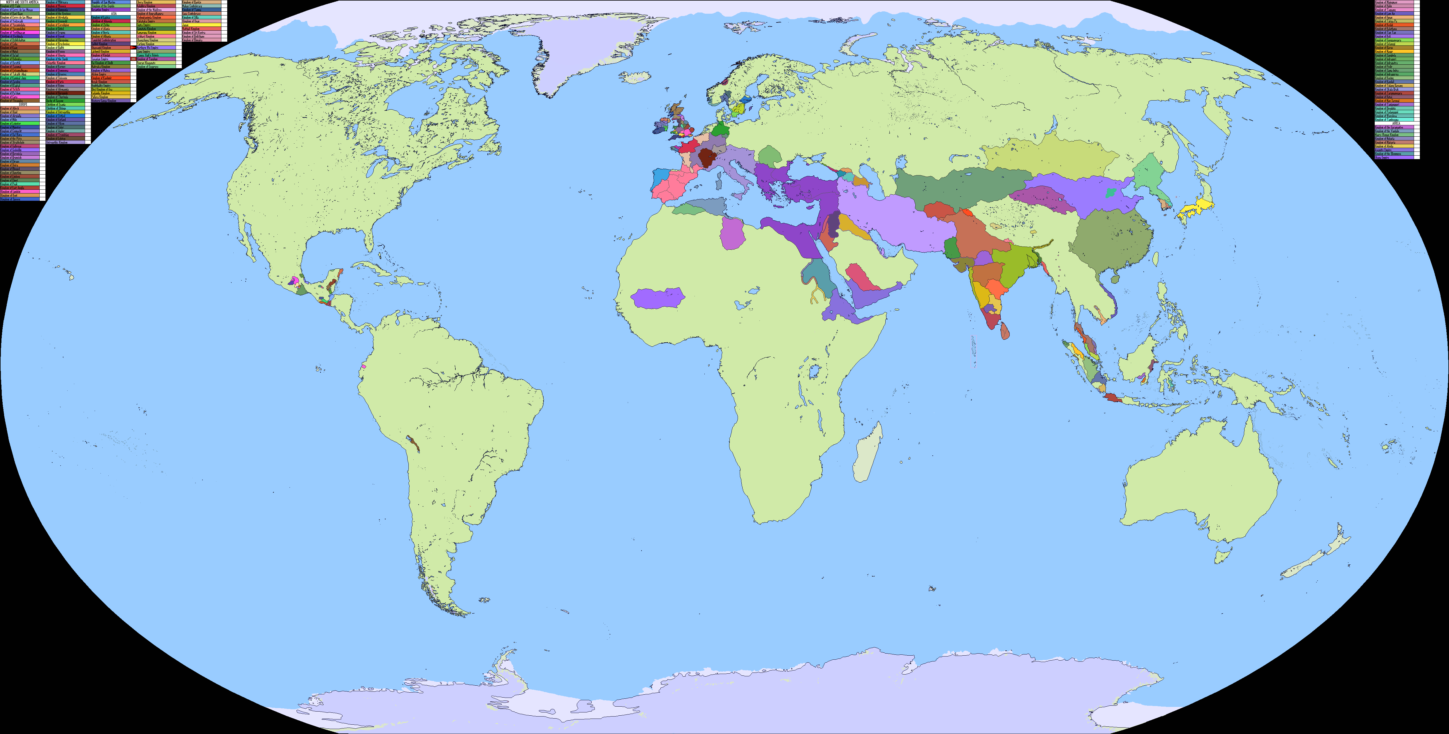
What's up with Borneo?
Really like the map but isn't Estonia missing some territories around Narva? Something like this:
September 1, 1939
Trying out some new border colors, and trying to represent still-official nations like the Dominions of GB and vassal/client/autonomous states that still have political relevance
Share: